My Zones Tool 
The My Zones tool allows you to create your own geographic features and access special map layers.
- My Zones allows you to define your own geographic areas of interest, which you can use to create alerts when vessels enter or exit the area.
- My POIs (Points of Interest) allows you to save specific points that you refer to often.
- General map features include US inland waterway and Elbe River markers and Gulf of Mexico lease blocks.
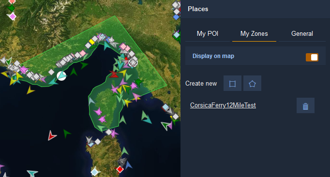
My Zones
To create a zone, draw a shape using the five-sided or square icons at the top right.
- Click on the five-sided icon
 to draw a polygon with the desired number of sides. Click once to create the first corner of your polygon, continue clicking to define the rest of the polygon's points, and click a final time on top of, or near the first corner to close the polygon.
 - Click on the square icon
 to define a rectangular zone, by clicking and dragging your mouse.
Once you've drawn the shape, you can enter your new zone's name and click Save. Click on the Zone's name in the list to navigate to its location on the map.
See the Alerts section to learn how to create alerts with your newly-defined My Zones.
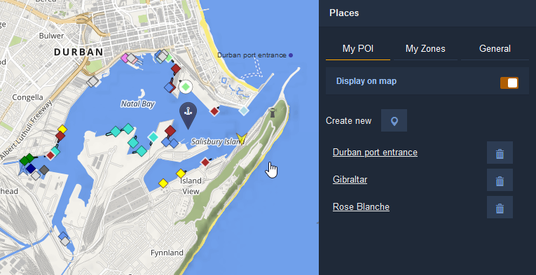
My POI
To create a Point of Interest, click on the blue marker icon  at the top/middle left of the sidebar, mark the location on the map, enter its name and click Save. Click on the Zone's name in the list to navigate to its location on the map.
General map features
Activates specialized map layers, such as:
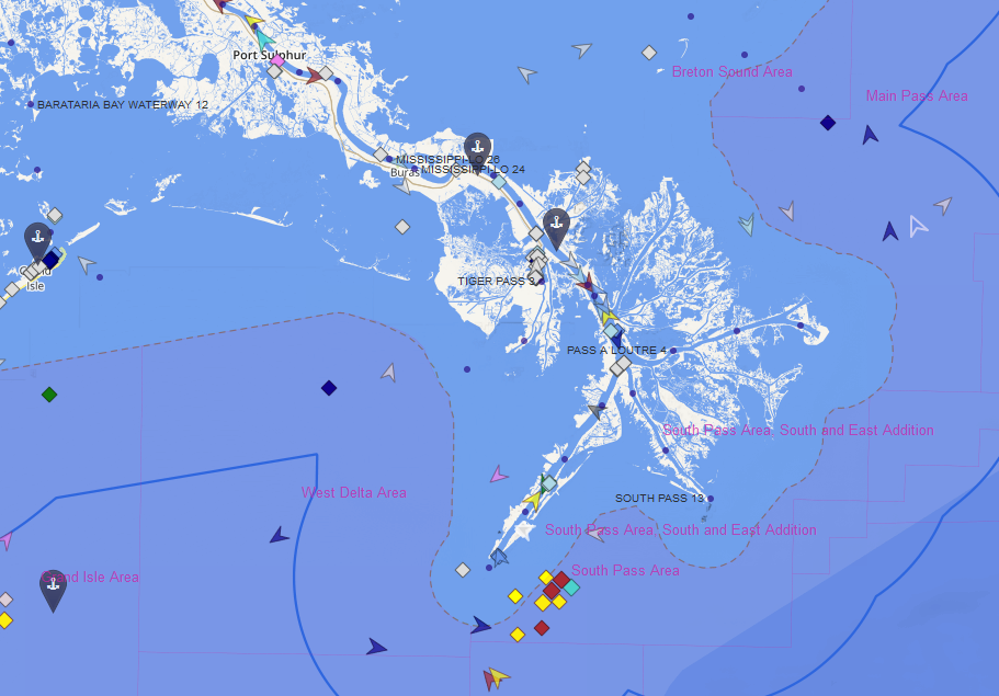
- Mile markers along the Mississippi River and other U.S. Inland waterways
- Kilometre markers along the Elbe River in Germany
- Lease blocks in the U.S. Gulf of Mexico