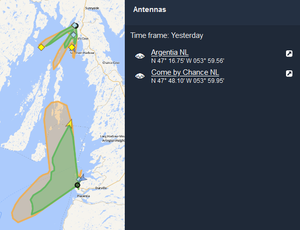
Antenna Coverage  (Antenna Operators only)
The Antenna Coverage tool in Cockpit allows antenna operators to see the coverage provided by antennas they host.
Coverage is shown as a polar chart radiating out in all directions from the antenna's position, and is calculated every 24 hours.
Note: if your antenna goes offline, the coverage map will show the data from the last day it was online.
Notes:
- The yellow chart shows the maximum distance a vessel was detected in each direction.
The green chart shows the median coverage distance, and therefore highlights zones of higher vessel activity.
Click on the eye icon
 to turn an antenna's coverage chart on and off.
Click on the pop-out icon
 to view the unit's Antenna Details Page in a new window.